Samdo to Samagaun covers about eight kilometers in three to four hours, dropping from roughly 3,875 meters to around 3,530 meters. It follows the Budhi Gandaki downstream through open alpine pasture, and it is one of the few stages on the Manaslu Circuit where you lose altitude rather than gain it.
Most trekkers walk this direction for one of two reasons. Either they hiked up to Samdo as part of acclimatization from Samagaun and are returning, or they have decided against the Larkya La crossing and are retreating to lower ground. Both are entirely normal.
What the Samdo to Samagaun Stage Involves
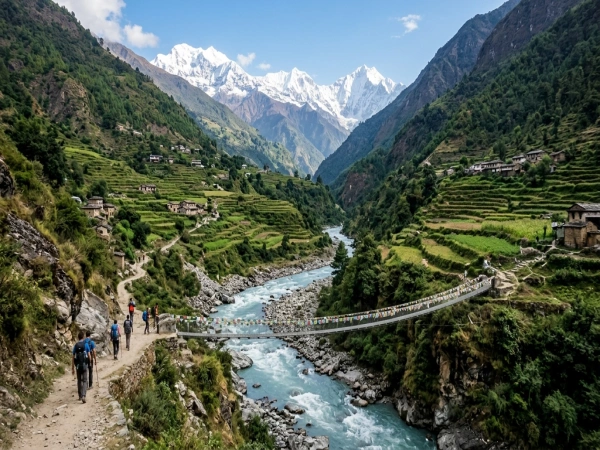
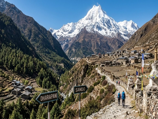
The trail leaves Samdo and follows the river valley south, staying on open ground with no forest cover whatsoever. Yaks graze across the slopes on both sides. Manaslu dominates the skyline ahead on clear mornings, and the valley widens noticeably as you approach Samagaun.
· Why This Stage Is Deliberately Short
Walking the standard direction, Samagaun to Samdo is kept short on purpose, usually three to four hours despite being only eight kilometers. The point is to spend time at altitude rather than cover ground. In reverse, the same logic applies in your favor since you are descending.
Nobody rushes this stage in either direction. Arriving at Samagaun by early afternoon leaves time to rest properly, which matters more at 3,530 meters than any distance covered. Fast walking at this altitude achieves nothing useful.
· What the Trail Itself Is Like
The path is wide, well established and easy underfoot. No technical sections, no exposed drops, no river crossings that need attention. Loose stone in places and some uneven ground, but nothing requiring poles unless you prefer them for the descent.
Mani walls carved with Buddhist mantras appear regularly along the route, as do small chortens. Pass both on the left, as is local custom, and it costs nothing to show respect. Prayer flags mark the trail's higher points.
What the Weather Does at This Altitude
Both villages sit in the high alpine zone, where conditions are cold, and the air is noticeably thin. Autumn days reach five to twelve degrees in sunshine and drop sharply when clouds arrive, or the sun goes behind a ridge.
Nights fall well below freezing year-round at both ends. Winter is severe and many lodges close. Monsoon between June and August brings cloud that hides Manaslu entirely for days at a time, which removes most of the reason to be here.
Autumn, from late September through November, and spring, from March to May, are the reliable windows. Mornings are usually clearest, with clouds building through the afternoon, so take photos of Manaslu early.
Where to Stay at Each End
Both villages have teahouses, though Samagaun has considerably more choice than Samdo.
· Teahouses in Samdo
Samdo has a handful of basic lodges with twin rooms, shared squat toilets and plywood partitions between rooms. Expect six hundred to twelve hundred rupees for a room. Hot showers are rarely available, and nothing is heated except the dining room.
Everybody gathers in that one dining room after dark because it is the only warm space. A sleeping bag rated to minus ten matters here. Charging a device costs two to five hundred rupees since power comes from solar.
· Teahouses in Samagaun
Samagaun is the largest village on the whole circuit and has the most lodges above Namrung. Rooms run six hundred to twelve hundred rupees, with slightly better facilities than Samdo and a few places offering hot showers for three to six hundred extra.
The village also has a health post, which matters if altitude symptoms have been part of why you came down. Some lodges offer Wi-Fi for three to six hundred rupees, but it works unreliably at best.
· Why Descending Helps Acclimatization
Dropping 330 meters sounds minor and genuinely helps. Sleeping lower after time spent higher is the basic principle behind climb high, sleep low. Anybody who struggled at Samdo usually sleeps considerably better at Samagaun.
If symptoms persist at 3,530 meters, continuing down to Lho (3,180 meters) or Namrung (2,630 meters) is the sensible next step. Never wait out a headache, nausea, or breathlessness at rest at altitude.
What Food Costs on This Stretch
Dal bhat remains the best value at both ends because it comes freshly cooked with free refills rather than sitting prepared. Expect nine hundred to fifteen hundred rupees at this altitude, since every ingredient arrives on a mule train or on somebody’s back.
Tea costs one to three hundred rupees. Noodles, soup, momos, chapati and simple Western dishes appear on most menus at similar price points. Avoid meat at this altitude since it travels without refrigeration for days before reaching the kitchen.
Garlic soup appears on every menu and genuinely helps with acclimatization. Budget three to five thousand rupees daily for food and lodging combined, which is roughly twenty-two to forty dollars per person.
Who Lives in These Two Villages
Both sit in the Nubri Valley, home to Tibetan communities that have lived here for centuries. The culture is Tibetan Buddhist rather than Hindu, and it shows in everything around you.
· Houses Built Against the Wind
Houses are low, flat-roofed and built from stone, with firewood stacked along the roof edges for winter fuel. Windows have carved wooden frames, often painted red and blue. Courtyards hold prayer flag poles marking each household.
The architecture is entirely practical rather than decorative. Wind at this altitude is constant, and the building style reflects that directly. Samdo in particular sits exposed, which explains why the houses hug the ground so closely.
· Yak Herding and the Tibet Trade
Samdo was settled by Tibetan refugees and families; they still trade across a nearby pass into Tibet. Yak herding supports most households at both ends, with animals grazing the high pasture through summer and sheltering lower in winter.
Samagaun has several gompas and a larger permanent population. People in both villages are used to trekkers without being commercial about it. A few words of Nepali go a long way, though many older residents speak Tibetan dialects first.
Which Vehicles Reach Samdo or Samagaun
Neither village has road access. No vehicle reaches anywhere between Jagat and Bimthang on this circuit, which means everything arriving in Samdo or Samagaun came by mule train or on a porter’s back.
That explains the food prices directly. A sack of rice reaching Samdo has been carried for several days from the roadhead. There is no route around this and no cheaper option available at altitude.
Helicopter evacuation is possible from both villages in a genuine emergency, arranged through your guide or agency. It is expensive and weather-dependent, so confirm that your travel insurance covers helicopter rescue at this altitude before you set out.
What to Do With the Spare Afternoon
Arriving in Samagaun by early afternoon leaves half a day free, and the village has more to see than anywhere else on the route.
· Birendra Lake and Manaslu Base Camp
Birendra Lake sits an easy hour from the village, a glacial lake below the Manaslu icefall with striking turquoise water. It's a gentle walk that aids acclimatization without demanding much.
Manaslu Base Camp at 4,800 meters is a hard day hike of six to eight hours and should only be attempted if you are feeling strong. Pungyen Gompa at around 4,000 meters offers a gentler four-hour alternative with excellent views.
Practical Notes for This Stage
Carry enough cash in rupees for the whole section since no ATM exists anywhere above Arughat. Lodges take no cards and prices here sit at their highest on the route.
Your Restricted Area Permit covers this corridor, and foreign trekkers need a licensed guide for the whole restricted zone. Keep permits accessible rather than buried in your pack, since checkposts verify them properly, not casually.
FAQ 1: How long does Samdo to Samagaun take?
A: Three to four hours across roughly eight kilometers, descending around 330 meters. The trail is wide and easy, with no technical sections.
FAQ 2: Can any vehicle reach Samagaun?
A: No. Nothing drives between Jagat and Bimthang, so all supplies arrive by mule or porter. Helicopter evacuation is the only motorized option in emergencies.